
Take a look at Garmin Basecamp and Rever. You can run Rever on your phone.


Take a look at Garmin Basecamp and Rever. You can run Rever on your phone.

Others have suggested some great scenic roads that you won't regret. But there are also some great opportunities for nostalgia in that part of the country. Of course I'm talking about Route 66!
From OKC west, Route 66 runs pretty close to I-40 most of the time. There are plenty of museums and old businesses and attractions in various states of repair. If you stay in some of the old 'Mom and Pop' motels you'll be surprised at who you'll meet. People from around the world see the road as a part of American history you can still live. A few years ago I was staying in Tucumcari, New Mexico. In the parking lot I met a group of 9 Swiss police officers riding rented Harleys for a European magazine article. I also met 3 older men from Australia who purchased a '65 Thunderbird convertible in Nashville, and were driving it along Route 66 to L.A. where they planned to ship it back home. They all loved the freedom Route 66 represented.
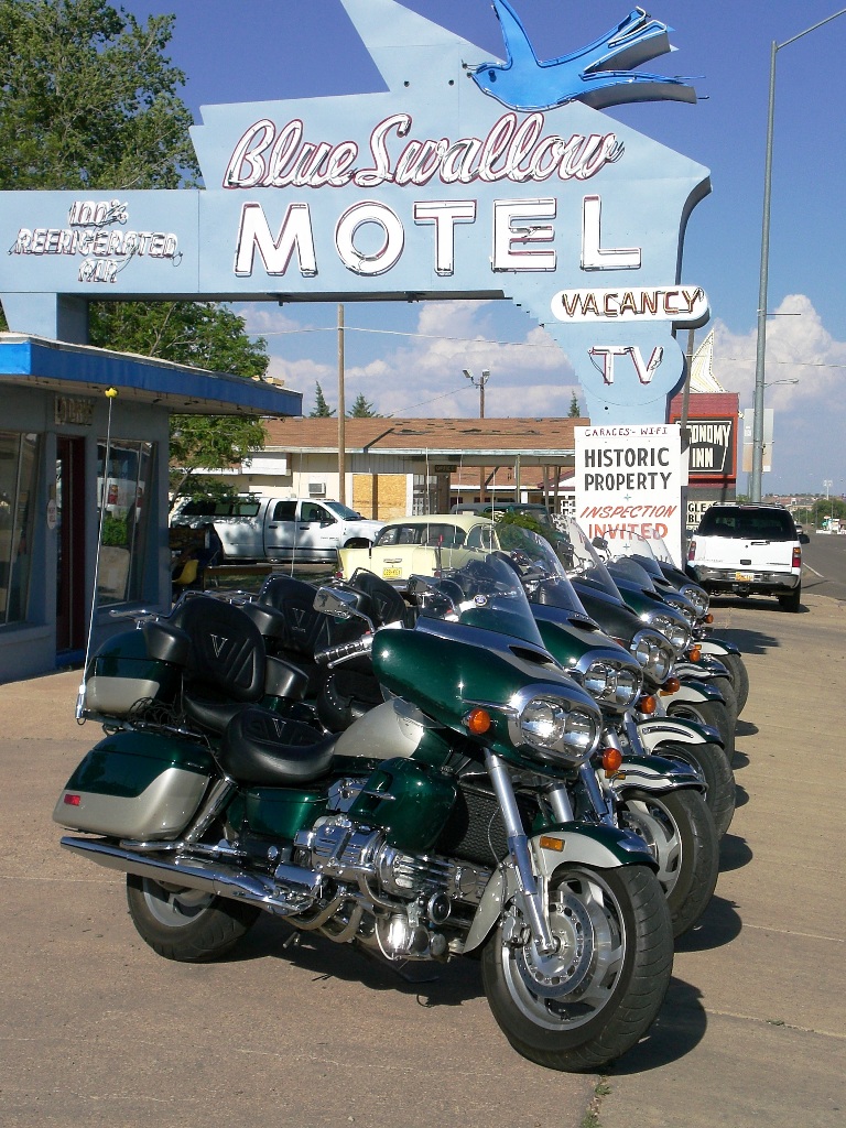
I was in Tucumcari for a Valkyrie BBQ at the Blue Swallow Motel, which claims to be the oldest Route 66 motel in continuous operation. Here's a great picture:
I'm adding my agreement to Butler Maps and Rever Trip Planning, and actually you can get the Butler Maps ON the Rever trip planning app. It's expensive, I think $100 for a years subscription.
2016 F6B Standard Matte Silver. Freedom Combat Slip-Ons, BaggerShield 11" - 19" Sport Shield, Kuryakyn Ergo II Highway Pegs, Ultimate King Seat w/Driver Backrest, Pathfinder Running/Turnsignal/Driving Lights, Beeline Moto Navigation, INNOVV K2 Camera, DHS Racing Shifter Linkage Upgrade, Show Chrome Handlebar Risers and Luggage Rack.
I agree. Get to the good stuff.Originally Posted by 2wheelsforme


As an option for route planning check Harley Davidson's website for their Harley Ride Planner, it is free and not hard to use. For years I used Microsoft Streets and Trips but they quit supporting and updating that in 2014. On Harley's website you will need to create a user profile and then select Ride Planner from the drop down menu. The first few times you use the ride planner might be a bit of a struggle but after you become familiar with it you will find it pretty easy to use. All trips you create will be stored under your profile then any trips can be converted to a gpx file which you can download to a GPS. I have found that I prefer this to Garmin Basecamp and that it is free is a bonus.
Enjoy the ride
Az Wingrider

[/QUOTE]
- Grand Canyon South Rim and North Rim
Zion National Park
Bryce Canyon National Park
UT-12 Red Canyon - Bryce Canyon - Escalante Grand Stair Case - Burr Trail (out to end of pavement and back) - Boulder Mountain
Capitol Reef National Park
Million Dollar Highway (US-550) Durango to Silverton to Ouray
Good list. Independence Pass coming down from Aspen is quite nice. Did the Dolores loop 2 yrs ago - Hwy 145 up to Telluride - very scenic.
Last edited by adventurous1; 04-29-2020 at 12:27 AM.
"Absorb what is useful, discard what is useless, and add what is uniquely your own." Bruce Lee
"The only thing worse than being blind is having sight but no vision." - Helen Keller
"Get busy living, or get busy dying." Andy Dufresne
Ah man - that road of nothingness kills me. Have only done it a couple times on a bike - several times in a car. Brutal.
"Absorb what is useful, discard what is useless, and add what is uniquely your own." Bruce Lee
"The only thing worse than being blind is having sight but no vision." - Helen Keller
"Get busy living, or get busy dying." Andy Dufresne

The only downside is every route is altered to take you to past HD dealerships, and lists prices of the T-shirts.
You can turn that feature off.
All in all, the HD app is pretty good. Mostly because it is not complicated.
IF you belong to AAA, go visit an office and work with a travel advisor to create "Trip Tix" for the proposed route. Then, using Google Maps, check out alternative roads that get you from Point A-B-C-D, etc. to gauge mileage and travel time for each segment. Once you settle on the route (# of miles/day, # of days, etc.), then do search for lodging options in or near your major waypoints.
If you don't belong to AAA... skip that part and just start with Google Maps.
Once I get a segment formalized, I screen grab the map and print it out to hardcopy in case my electronics go sideways.
Enjoy - hope the ride works out!
 Posting Permissions

 Reply With Quote